Crockett County has a unique history to share. It was named in 1875 to commemorate the illustrious David Crockett of Alamo fame. He was killed in battle March 5, 1836, 5 months short of 50 years after his birth in Tennessee. He never trod the soil nor beheld its beauty, but he is forever linked to the county that proudly bears his name.
Crockett County is the eighth largest of 254 counties in Texas and covers over 3,000 square miles of ruggedly beautiful west Texas. The one and only town within its boundaries is Ozona, which is known as “The Biggest Little Town in the World,” with about 3,500 persons calling it “home”. The town is un-incorporated and, although being rather isolated from other towns, is quite independent. Ranching and oil/gas businesses keep the economy steady and school activities keep everyone involved.

Crockett County is proud of its heritage, and the Museum on the square shelters the artifacts and shares the stories of its inhabitants from 10,000 B.C. to present day. To the traveler, a stop at the Museum promises a new appreciation for this area of West Texas, as the stories are told about how E.M. Powell acquired a lot of acreage around present-day Ozona. He had surveyed a lot of West Texas and the State paid him in land. He came out to see what was his and found a tree–just a live-oak tree–and Ozona grew up around this tree which still stands. There’s a lot more to this story and the Museum invites everyone to come in and hear all of it–and more. Visit 9 a.m. to 5 p.m. Monday through Friday.
TEXAS PECOS TRAIL
Ozona is located on the Texas Historical Commission’s Texas Pecos Trail. Experience the legendary Wild West of classic books and movies, and the real-life landscape of the Texas Pecos Trail Region. Twenty-two counties cover 35,000 square miles and comprise an ecological transition zone at the junction of the VPlains to the north, Edwards Plateau in the east, Chihuahuan Desert in the west, and the Brush Country in the south.
HEART OF TEXAS WEST WILDLIFE TRAIL
Whether you enjoy bird watching, hiking trails, caverns or just driving the wild western side of Texas, you’ll want to pick up a copy of the Heart of Texas West Wildlife Trail Map designed by the Texas Parks & Wildlife Department. The Crockett County Interpretive Trail located across the parking area from the Ozona Chamber of Commerce & Visitor Center makes a great launching point to start your journey. Pick up a copy inside the Visitor Center or use the online map to
get started. With 103 attractions, wildlife sites and trails, there is something for everyone! Stop by the Chamber & Visitor’s Center to pick up your Heart of Texas West Wildlife Trail map!
ESCONDIDO DRAW RECREATIONAL AREA (EDRA)
The Escondido Draw Recreational Area (EDRA) is a 3,500 acre Off Road Vehicle riding area and nature park. It is open to the public where all-terrain vehicles, side by side, dirt bikes, and 4-wheel drive vehicles are ridden.
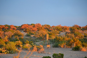
The park invites all outdoor activities, i.e. primitive camping, hiking, photography, and stargazing. RV camping sites are available with 50 amp electric power, potable water, septic, toilets/showers, a store and pavilion. Come see our birds! Over 75 bird species ahave been documented, including Golden Eagles.
CROCKETT COUNTY INTERPRETIVE TRAIL & VISITOR CENTER PARK
This exhibit is an interpretation of plant material in its native habitat within a 100 mile radius of Ozona. The trail includes a Rain Harvest Exhibit with signage on the process of collecting water for landscaping, livestock watering or home use. There is also a wildlife viewing area and a watering hole for birds and butterflies. Located at the Ozona Chamber of Commerce and Visitor Center (the intersection of I-10 and State Hwy 163 S). For more info visit Ozona.com.
FORT LANCASTER STATE HISTORIC SITE
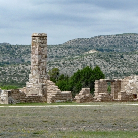
The 82-acre park was originally donated to Crockett County in 1965 by the Meadows and Benckenstein families for preservation and public use of the site and was transferred to the Texas Parks and Wildlife Department in 1968. Today it is managed by the Texas Historical Commission. Originally established as Camp Lancaster in 1855, the fort was strategically located on the military road between San Antonio and El Paso, near an important river crossing which an early surveyor called Indian Ford. Fort Lancaster was one of four posts placed to protect the route. At the height of development, it consisted of 25 permanent buildings and had an average complement of 72 men and four officers. During the Civil War, the fort was abandoned by the federal troops to be manned for a very brief period by the W. P. Lane Rangers (Texas Rangers). Company K of the 9th Cavalry (Buffalo Soldiers) occupied the Fort in 1867 and 1868. During their occupancy, a one day battle was fought on the fort site. Eventually Fort Lancaster was abandoned and never garrisoned troops again.
Located approximately 33 miles west of Ozona, this site is open Tuesday through Saturday from 9:00 a.m. to 5:00 p.m.
FOR ALL THINGS IN AND AROUND OZONA VISIT
OZONA.COM.

